
From the Beach to the Brasada
Or, how to make a long trip even longer.

The beach was a bust. The weather on South Padre Island was marginal at best. No sun, no real heat and plenty of wind blown sand. Call me demanding, but that’s not exactly what I was looking for in a beach weekend. South Padre is a long barrier island in a series up the Gulf coast that protects Texas from Hurricanes, oil tankers and drunk fishermen. You can drive on the beach here, and that’s what I did, to a point. Then the wind blown surf from a storm offshore washed out the hard pack single lane and forced me to turn around. Seems the tide had somehow come in while I was out there and at one point found myself having to push through the surf to get back to civilization. I think there’s still some seaweed stuck to the underpinnings of the Jeep, but who cares really, I was just glad to make it back to the pavement without getting stuck. To make this trip break-even, I was going to need a more pleasurable drive home then normal and the Rio Grande Valley was hopefully just what I needed.
I found my way to Port Isabel, just across the Queen Isabella Causeway and back on the mainland. Now a home to a small shrimping fleet, the area was the site of the last battle of the Civil War. The Battle of Palmito Ranch was fought after the South’s surrender at Appomatix. Whoops, sorry about that. The Yanks wound up getting the last word, though, and it was called Reconstruction. Guess they showed us.
I picked up a small blacktop “road” that led to Brownsville, the last city on the Rio Grande before it meets its end in the sea. The city’s glory days rode off with the last of the cattle herds at the end of the 19th century. Too isolated from the rest of the state, Brownsville was left neglected, and its French influenced architecture was swallowed up. The city of 140,000 varies little from its Mexican brother across the diminuative Rio Grande and even I was shocked by how much it resembled Matamoros these days. The amount of cross border traffic is significant and nearly half of the vehicles I saw in the Valley had Mexican license plates. The cities in the Valley are too far isolated from the rest of the state and rely heavily on this trade with its Mexican neighbors and family across the river.
I found my way to US 281 in Downtown Brownsville, just across from the crowded International Bridge. I was headed westbound for Hildalgo, Progreso, Rio Grande City and Roma and this two lane rural highway follows the meandering Rio Grande and remains south of the booming NAFTA trade centers of McAllen and Harlingen. These small towns have been left untouched by the generic growth of their northern neighbors. They lay alongside the river, neglected and unused, a time capsule of a long gone era.
 All along US 281 you see relatively ancient land holdings that date back to the time of the Spanish Empire and the King’s Merced. Vast narrow tracts, connected by irrigation canals, that run perpendicular to the river for miles. The agriculture fields are dotted with little villages and colorful cemeteries, the river is never more then a few feet from the highway. This land has seen more then it’s share of misery; from the various problems with marauding Comanche, the subsequent split with Mexico and the resulting Mexican-American War, followed by the Civil War and Reconstruction. This tumultuous past lies scattered across the landscape, untouched by modern growth.
 We went our separate ways, US 281 and I, at Hidalgo. She was moving on towards San Antonio 250 miles to the north, past the million acre King Ranch and I still wanted to head west further up the river. I found my new traveling companion, one remarkably understated two lane US 83. As soon as we had gotten officially acquainted, I left her for a small unmarked single lane blacktop headed south for the Los Ebanos Ferry. A place much talked about amongst the wandering nomads of South Texas, but seldom visited. For good reason apparently, it’s damn hard to find and rarely on most maps. But there it was, on my Atlas after all.
Upon finding Los Ebanos amidst a Cotton Wood grove, I proceeded to get lost is this rather spooky and foreign village. I was trying to find the old ferry to Mexico, a frightful task in an unmarked and little traveled area of the Valley. When I finally did locate the last remaining hand-drawn-ferry in the country, it was of course, closed for the day. I cursed my bad luck and returned to task of very slowly finding my way home. .
Further on up the road, I met up with Rio Grande City. A rather clever name of a town with an interesting past, it was occupied early in Civil War by Texas Confederates under Col. John “RIP” Ford. Vital in chain of posts used to defend the 2,000 mile Texas frontier, coastline and border always threatened by attacks from Indians, bandits and Federal troops it also served as an official Confederate port of entry, customhouse and major terminus of the cotton road to Mexico. Cotton was the one great money crop of the South that could be sold to hungry European mills for cash for necessary arms, munitions and drugs that could only come from Europe. International ports on the Rio Grande were the South's frail lifelines, its last resource in a war with an industrialized North that manufactured for its self what the South had to import. Cotton arrived at this booming border town on wagons and oxcarts after a hot and dusty trip across the brasada. It was then ferried across the river and delivered to the neutral ships anchored in the Gulf at Matamoros.

Roma is the oldest city on the US side of the river. Founded in 1765, this once riverboat town sits on a bluff fifty feet over the now un-navigable river. From here, paddlewheel ships, owned by such famous Texans as Mifflin Kenedy, plied the Rio Grande, delivering goods from Mexico's interior to the Port of Brownsville. The Reconstruction Years, brought growth and prosperity to the town. The smuggling of contraband became a highly organized, and if not completely respected, flourishing business that amounted to hundreds of thousands of dollars.
I was headed home, finally. Ah, ok, one more historical marker in the middle of nowhere. I pull over at the long abandoned site of a mission that has since returned to dirt, its name lost to the internet. Speaking of dirt, look at that nice graded dirt road, it heads north. I’m headed north. Coincidence? I think not. I pull out the map, disregard the little bar scale and head north. Into the vast emptiness of the Texas Brasada, where, they say, everything sticks, stings and/or bites. An hour was spent on this dirt “road”, mile upon mile of barbed wire fences, cattle guards, arroyo crossings and nary a human in site. My kind of place.
The road, which doesn’t even have a county designation, finally spits me out onto pavement after several wrong turns and I continued north through the brush country only occasionally greeted by a lone Crested Caracara on a cedar fence post. I would be home in two hours, tired and beat from the drive. Somehow, I managed to create a nine hour drive out of what took me four originally. I’ve always been the “slow one” I guess.
I have nothing profound or insightful to add to this play-by-play as I have found it too hard to define a place only seen through a windsheild that is at once both American and Mexican. Old world and booming suburban sprawl. Utterly provincial and highly International. Desperately poor and new job rich. 'Round here, we simply call it the Valley.
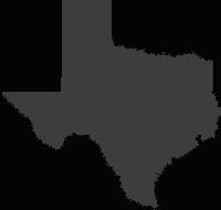
View a Map of the Valley and my route along the border.
Avoid the swift moving interstate, that’s just too easy and too dull. Life lies beyond the vast expanse of concrete, dividers and properly marked lanes and you might as well enjoy it. What’s the rush anyway? It’s not like you’ve got anything worthwhile going on back home.
Take along a camera, preferably one that works most of the time. Oh, and, you might want to bring some film along too. That would also be beneficial.
Throw that trusty map in the back seat and try and “feel” your way through the back roads. Only pull the map out in dire situations where you are hopelessly lost and completely out of gas.
The rougher and less traveled a road the better. Smooth roads offer little charm and don’t do anything but put you to sleep anyway.
Develop a hankering for useless roadside history and stop at every Historical Marker along the way. You know, every two or three miles. It helps make “great time” getting home.
Roll the windows down and slow down. Smell the wind and be a part of the local scenery. No need to fuss over your hair, it’s not like you’re going to meet anyone out here anyway. And if you do, you don’t want to look the part of the “outsider” that’s all gussied-up.
Stop once every two hours or so to “top off the tank”. Err, I mean, use the restroom. You drink too much coffee.
The beach was a bust. The weather on South Padre Island was marginal at best. No sun, no real heat and plenty of wind blown sand. Call me demanding, but that’s not exactly what I was looking for in a beach weekend. South Padre is a long barrier island in a series up the Gulf coast that protects Texas from Hurricanes, oil tankers and drunk fishermen.
 You can drive on the beach here, and that’s what I did, to a point. Then the wind blown surf from a storm offshore washed out the hard pack single lane and forced me to turn around. Seems the tide had somehow come in while I was out there and at one point found myself having to push through the surf to get back to civilization. I think there’s still some seaweed stuck to the underpinnings of the Jeep, but who cares really, I was just glad to make it back to the pavement without getting stuck. To make this trip break-even, I was going to need a more pleasurable drive home then normal and the Rio Grande Valley was hopefully just what I needed.
I found my way to Port Isabel, just across the Queen Isabella Causeway and back on the mainland. Now a home to a small shrimping fleet,
 the area was the site of the last battle of the Civil War. The Battle of Palmito Ranch was fought after the South’s surrender at Appomatix. Whoops, sorry about that. The Yanks wound up getting the last word, though, and it was called Reconstruction. Guess they showed us.
I picked up a small blacktop “road” that led to Brownsville, the last city on the Rio Grande before it meets its end in the sea.
 The city’s glory days rode off with the last of the cattle herds at the end of the 19th century. Too isolated from the rest of the state, Brownsville was left neglected, and its French influenced architecture was swallowed up. The city of 140,000 varies little from its Mexican brother across the diminuative Rio Grande and even I was shocked by how much it resembled Matamoros these days. The amount of cross border traffic is significant and nearly half of the vehicles I saw in the Valley had Mexican license plates. The cities in the Valley are too far isolated from the rest of the state and rely heavily on this trade with its Mexican neighbors and family across the river.
I found my way to US 281 in Downtown Brownsville, just across from the crowded International Bridge. I was headed westbound for Hildalgo, Progreso, Rio Grande City and Roma and this two lane rural highway follows the meandering Rio Grande and remains south of the booming NAFTA trade centers of McAllen and Harlingen. These small towns have been left untouched by the generic growth of their northern neighbors. They lay alongside the river, neglected and unused, a time capsule of a long gone era.
 All along US 281 you see relatively ancient land holdings that date back to the time of the Spanish Empire and the King’s Merced. Vast narrow tracts, connected by irrigation canals, that run perpendicular to the river for miles. The agriculture fields are dotted with little villages and colorful cemeteries, the river is never more then a few feet from the highway. This land has seen more then it’s share of misery; from the various problems with marauding Comanche, the subsequent split with Mexico and the resulting Mexican-American War, followed by the Civil War and Reconstruction. This tumultuous past lies scattered across the landscape, untouched by modern growth.
 We went our separate ways, US 281 and I, at Hidalgo. She was moving on towards San Antonio 250 miles to the north, past the million acre King Ranch and I still wanted to head west further up the river. I found my new traveling companion, one remarkably understated two lane US 83. As soon as we had gotten officially acquainted, I left her for a small unmarked single lane blacktop headed south for the Los Ebanos Ferry. A place much talked about amongst the wandering nomads of South Texas, but seldom visited. For good reason apparently, it’s damn hard to find and rarely on most maps. But there it was, on my Atlas after all.
Upon finding Los Ebanos amidst a Cotton Wood grove, I proceeded to get lost is this rather spooky and foreign village. I was trying to find the old ferry to Mexico, a frightful task in an unmarked and little traveled area of the Valley. When I finally did locate the last remaining hand-drawn-ferry in the country, it was of course, closed for the day. I cursed my bad luck and returned to task of very slowly finding my way home. .
Further on up the road, I met up with Rio Grande City. A rather clever name of a town with an interesting past, it was occupied early in Civil War by Texas Confederates under Col. John “RIP” Ford. Vital in chain of posts used to defend the 2,000 mile Texas frontier, coastline and border always threatened by attacks from Indians, bandits and Federal troops it also served as an official Confederate port of entry, customhouse and major terminus of the cotton road to Mexico. Cotton was the one great money crop of the South that could be sold to hungry European mills for cash for necessary arms, munitions and drugs that could only come from Europe. International ports on the Rio Grande were the South's frail lifelines, its last resource in a war with an industrialized North that manufactured for its self what the South had to import. Cotton arrived at this booming border town on wagons and oxcarts after a hot and dusty trip across the brasada. It was then ferried across the river and delivered to the neutral ships anchored in the Gulf at Matamoros.
Roma is the oldest city on the US side of the river. Founded in 1765, this once riverboat town sits on a bluff fifty feet over the now un-navigable river. From here, paddlewheel ships, owned by such famous Texans as Mifflin Kenedy, plied the Rio Grande, delivering goods from Mexico's interior to the Port of Brownsville. The Reconstruction Years, brought growth and prosperity to the town. The smuggling of contraband became a highly organized, and if not completely respected, flourishing business that amounted to hundreds of thousands of dollars.
I was headed home, finally. Ah, ok, one more historical marker in the middle of nowhere. I pull over at the long abandoned site of a mission that has since returned to dirt, its name lost to the internet. Speaking of dirt, look at that nice graded dirt road, it heads north. I’m headed north. Coincidence? I think not. I pull out the map, disregard the little bar scale and head north.
 Into the vast emptiness of the Texas Brasada, where, they say, everything sticks, stings and/or bites. An hour was spent on this dirt “road”, mile upon mile of barbed wire fences, cattle guards, arroyo crossings and nary a human in site. My kind of place.
The road, which doesn’t even have a county designation, finally spits me out onto pavement after several wrong turns and I continued north through the brush country only occasionally greeted by a lone Crested Caracara on a cedar fence post. I would be home in two hours, tired and beat from the drive. Somehow, I managed to create a nine hour drive out of what took me four originally. I’ve always been the “slow one” I guess.
I have nothing profound or insightful to add to this play-by-play as I have found it too hard to define a place only seen through a windsheild that is at once both American and Mexican. Old world and booming suburban sprawl. Utterly provincial and highly International. Desperately poor and new job rich. 'Round here, we simply call it the Valley.
View a Map of the Valley and my route along the border.
Seven Easy Steps in making a trip twice as long as it should be:
1
Avoid the swift moving interstate, that’s just too easy and too dull. Life lies beyond the vast expanse of concrete, dividers and properly marked lanes and you might as well enjoy it. What’s the rush anyway? It’s not like you’ve got anything worthwhile going on back home.
2
Take along a camera, preferably one that works most of the time. Oh, and, you might want to bring some film along too. That would also be beneficial.
3
Throw that trusty map in the back seat and try and “feel” your way through the back roads. Only pull the map out in dire situations where you are hopelessly lost and completely out of gas.
4
The rougher and less traveled a road the better. Smooth roads offer little charm and don’t do anything but put you to sleep anyway.
5
Develop a hankering for useless roadside history and stop at every Historical Marker along the way. You know, every two or three miles. It helps make “great time” getting home.
6
Roll the windows down and slow down. Smell the wind and be a part of the local scenery. No need to fuss over your hair, it’s not like you’re going to meet anyone out here anyway. And if you do, you don’t want to look the part of the “outsider” that’s all gussied-up.
7
Stop once every two hours or so to “top off the tank”. Err, I mean, use the restroom. You drink too much coffee.
posted by Paul Bubel at 1:53 PM
![]()
![]()


<< Home